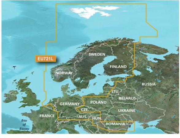
Nyt kæmpe kort fra Garmin der dækker de flestes behov. Smart at have et stort kort der dækker alt og så er det enda med Vision funktioner samt Garmin og Navionics data
Producentens beskrivelse:
Our Premium Chart Offering
Derived from official charts and private sources to provide navigational aids, spot soundings, depth contours, tides and currents, and detailed harbors and marinas
Garmin Auto Guidance technology shows a suggested route to a destination¹
Depth Range Shading for up to 10 depth ranges enables you to view your target depth at a glance
Up to 1-foot contours provide a more accurate depiction of the bottom structure for improved fishing charts and navigation
Shallow Water Shading feature allows for depth shading at a user-defined level to aid in navigation
Unique 3D views like MarinerEye and FishEye provide additional perspective both above and below the water line
High-resolution satellite imagery of ports, marinas, bridges and navigational landmarks for superior situational awareness
Worldwide coverage available
Keep your charts up to date with our industry-leading New Chart Guarantee and discount card update program
Auto Guidance¹
Auto Guidance technology quickly calculates a suggested route using your boat's dimensions and a suggested path to follow.
Depth Range Shading
Displays high-resolution Depth Range Shading for up to 10 depth ranges so you can view your designated target depth.
Detailed Contours
BlueChart g2 Vision HD features 1-foot contours that provide a more accurate depiction of bottom structure for improved fishing charts and enhanced detail in swamps, canals and port plans.
MarinerEye View
Provides a 3-D representation of the ocean floor as seen from below the waterline.
FishEye View
Provides a 3-D representation of the surrounding area both above and below the waterline.
High-resolution Satellite Imagery
High-resolution satellite imagery with navigational charts overlaid gives you a realistic view of your surroundings so you can navigate with a clear moving-chart representation of your boat’s position. It’s our most realistic charting display in a chartplotter.
Aerial Photography
Crystal clear aerial photography shows exceptional detail of many ports, harbors and marinas and is ideal when entering unfamiliar ports.
| Vare: | Vejl: | Nu: | |
| Garmin Bluechart G3 Vision HD VEU721L | 2.999,- | 2.799,- |  |
mail@jagtogfiskerimagasinet.dk
Se andre produkter fra samme mærke
Garmin

Tilbehør
Klik på produktet for yderligere information
Garmin Gpsmap 8412/8412xsv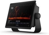 Før: 28.999,- Nu: 25.999,- |
Garmin Gpsmap 8416/8416xsv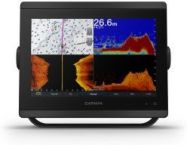 Før: 44.999,- Nu fra: 39.999,- |
Garmin NMEA 2000 Startkit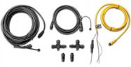 Før: 799,- Nu: 699,- |
 Indkøbsliste

